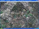
USA Photo Maps 2.77

- Categoría: Misc. Home and Entertainment
- Licencia: Freeware
- Tamaño: < 1 KB
- Sistema: w98 wNT wME w2000 wXP
- Idiomas:

Directly download maps and topographic data to your hard drive for any part of the USA.
As you will have no doubt already worked out by now just from the name of this application, USA Photo Maps works to download U.S.Geological Survey aerial photos and topographical map data directly from Microsoft's free MSRMaps.com website, saving it to your hard drive and creating maps from there.
With USA Photo Maps you can do the following: scroll and zoom operations, see latitudes and longitudes, see UGSS Landmarks, see contours and elevation lines, add points, routes and texts to the maps, go to any location on the map of the USA, see transfer points, tracks and routes from the majority of GPS receivers, check which is your GPS location and much, much more.
With this USA Photo Maps program you just have to download enough maps to fill your screen, and then that's it, your map is complete. You can then save it to your hard drive and work on it like any other map. It is also very easy to download, install and then use, through its friendly and intuitive user interface. You don't need any technical experience at all to get the most out of it.
So there you have it. If you want the ability to create maps from aerial photos of the USA, then you need a program like this USA Photo Maps. And best of all is that you can download it for free! What are you waiting for?
DownloadUSA Photo Maps 2.77 related downloads
Ghost-Tech Paranormal Investigator 1.0
 Download
Become an investigator and use this technical tool in the paranormal world.


